Report by Margaret Jones
The meeting point was at Garston, conveniently close to the Coffee Bomb for those having a late breakfast or early lunch. Most vehicles were ready at the appointed hour of 10.15am, and to clear the parking space we moved south to the start of the track. Here we took the opportunity to air down while waiting for one or two late arrivals, making 12 vehicles in total – 5 Mitsubishis, 4 Toyotas, 2 Nissans and 1 Land Rover.
Keith Milne was our trip leader, and he gave a thorough briefing on what to expect, how best to manage the terrain, and health & safety procedures. In order to keep things moving, Keith divided us into 2 groups, with experienced drivers first, last, and in the middle of each group available to provide aid if needed. Keith led the first group with Raymond Keys as tail end Charlie. The second group was led by Dave P with Kevin as tail end Charlie, and we were in the middle of this second group.
Keith also accepted the nomination for me to write the trip report (thanks Derek for speaking up). So, here it is.
Being in the second group we had the advantage of watching group 1 make their way up the steep hill. This first ascent zig zagged up a track on lush, green grass with plenty of tight corners. On the outside of the corners there was nothing to stop a rapid descent if anyone make a miscalculation. There were times when I found myself holding on tight. Everyone managed well and only occasionally did a longer vehicle need to reverse back to take a better line. We took it slowly, allowing plenty of space between vehicles in case one slipped backwards, but also to not put pressure on the one in front.
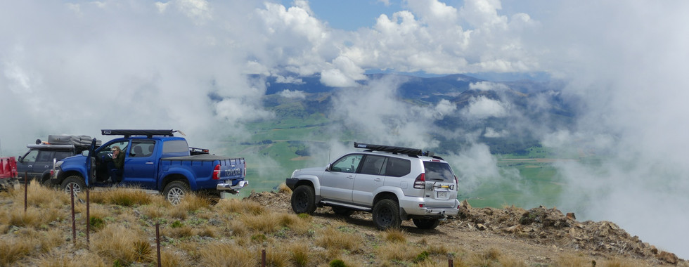
Our group had an unscheduled stop when Ray M’s Pajero transmission started to overheat. A stop of 5 or 10 minutes was enough to cool down, while we took photos of the magnificent views across the valley. When underway again Dave stepped up the pace to increase airflow and hopefully prevent further over heating – it worked a treat.
Climbing higher, above 1000 metres, we entered the area of dead pines. Compared to the well-kept farmland below, this area was desolate with dead and broken trees and fallen branches. The cloud rolled in and enveloped us into this bleak landscape. Just above the trees we stopped to bring together both groups and have a quick coffee.
Lunch was only another 30 minutes away at a weather station just above the saddle. Here we had lunch, compared notes, took photos, chatted, inspected each other’s truck fitouts, and sheltered from the occasional rain showers.
By 2 o’clock we were underway again and heading up a zig zag track to Mt Cupola (1368 metres). This short but steep section took about 20 minutes. At the top we had views across the ranges and steep valleys to the east and further afield to the southland plains. We had to be quick to capture these views before the cloud rolled in and obscured everything. However, keen eyes with the aid of binoculars had spotted 3 deer and 1 large pig. Perhaps they made a note to come back another day for a closer look. From here we drove along a narrow ridge then it was all downhill.
It did seem like a long way downhill, sometimes very steep, and with plenty of switchbacks. To save our brakes we travelled in low-range 1st or 2nd gear. As we descended the track gradually became softer until eventually, we were back on the grass and the going was much smoother.
Back at the farmyards, out came the compressors and there was general racket while everyone aired-up. After saying thank you and goodbye Derek and I left in order to pick up our pooch from the kennels (made it with 2 minutes to spare). By doing so we missed the trip “debrief” at Kingston, but I am sure the consensus was that it was an admirable trip.
Overall, the trip duration was 4 hours and 10 minutes, with travelling time of 1 hour and 53 minutes (seemed much longer at times), and we covered 17kms.
Thank you, Keith, and everyone on the trip for a great day out.


Commentaires